Monday, March 24, 2008

Snow and ice all clear. Sand? Still plenty.

The path is practically clear of snow and ice from end to end now. I looped from Milepost V to the Bedford end at lunchtime today and found it all wide open. The crossings are still sandy and the path is still littered, but it's improving rapidly.

Today: 10 miles. This year: 30.2 miles.

Wednesday, March 19, 2008

Hitting the sand

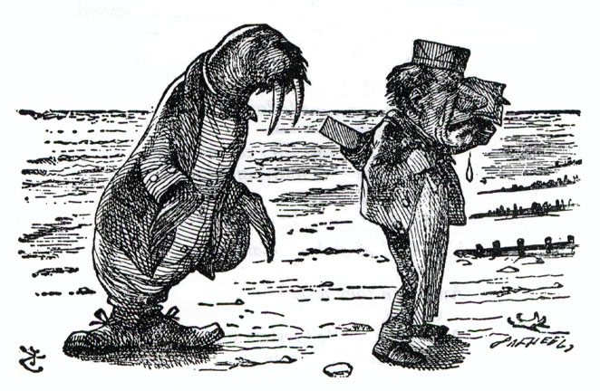
While I was glad to have gloves yesterday, a broom is what I needed to improve the trail. I took a dive in a sandy spot at the Bow Street crossing and skinned my wrist guards. These conditions remind me of The Walrus and The Carpenter:

The Walrus and the Carpenter
Were walking close at hand;
They wept like anything to see
Such quantities of sand:
"If this were only cleared away,"
They said, "it would be grand!"

"If seven maids with seven mops
Swept it for half a year.
Do you suppose," the Walrus said,
"That they could get it clear?"
"I doubt it," said the Carpenter,
And shed a bitter tear.

Unlike them, I'm sure that street sweepers, rain, and trail traffic will soon clean the mess.

Tuesday, March 18, 2008

Sunny, Calm, and Not That Warm

Today was beautiful: sunny, calm, and not as warm as it looked. I was glad to have a pair of Asics running gloves, very cheap on final clearance at the sports store on Main Street in Concord. They're thin enough to go inside the wrist guards and breathable enough that my hands aren't sweat-soaked. Apart from the chill, today was a huge improvement over one year ago today. This year the trail is clear from Alewife, all through Arlington, and past Seasons Four in Lexington. There's snow cover after the private driveway crossing.

West from the private crossing

Somehow I've never noticed the map of the Arlington Center crossing standing near Mystic Street in the shadow of Uncle Sam. It helpfully explains the crossing layout and vainly implores riders to walk their bikes or follow the traffic rules. Nice try.

At Mystic Street, Arlington

Today: 8 miles. This year: 20.2 miles.
Friday, March 7, 2008

Sporadic Clearing

Arlington plowed the trail this winter and Lexington didn't. The trail is largely clear and dry in Arlington, save for a little debris and runoff in spots. Even where the snow has melted in Lexington there's the whole winter's wrack, scattered or in heaps, strewn along the trail.

Traveling west from Hurd Field yesterday I skirted around the messes, struggled through a couple of sandy crossings, and turned back behind Lexington Toyota where snow and ice covered the trail completely. In the opposite direction was the opposite story: all clear down to Mill Street. Daytime melting and torrential rain will clear much of Lexington's snow in the next few days, then there's just the debris to sweep away.

Looking west behind Lexington Toyota

Yesterday: 4.7 miles. This year: 12.2 miles.

Thursday, January 10, 2008

Sunny and warm - for January

The trail is clear of snow and ice all through Arlington, from Alewife Station in the east to Mal's garage in the west. There's a little meltwater, a few tons of sand, plenty of sticks and leaves. The ice is solid from Mal's on out.

Milepost 0 at Alewife

Alewives on Milepost 0

Leaves near Spy Pond Field

The clear trail ends at Mal's

Today: 7.5 miles. This year: 7.5 miles.

Tuesday, January 1, 2008

Welcome to 2008

What's this about? Read The Beginning.

I missed my goal in 2007, so I'm trying once more to skate the distance from Arlington, MA to Stillwater, OK (1636.5 miles over the road, 1453.1 miles on a great circle) before next winter closes the trail again. Arlington's plowing of the trail might lead to an early start this year and a better chance at meeting my goal. Once again, I'm tracking my progress on a Google spreadsheet. Terminally geeky, I know.

If you're just here to enjoy the view, you can skip reading all the old postings and go straight to the photo album. But it's no substitute for hitting the trail yourself.

Saturday, December 29, 2007

Google Street View

Google Maps Street View covers much of the Boston area now, including nearly all of Arlington and much of Lexington. A Google LatLong Blog post explains how to embed street views in other web pages, so here we go. The location is the Bow Street crossing of the bikeway in East Lexington.


View Larger Map